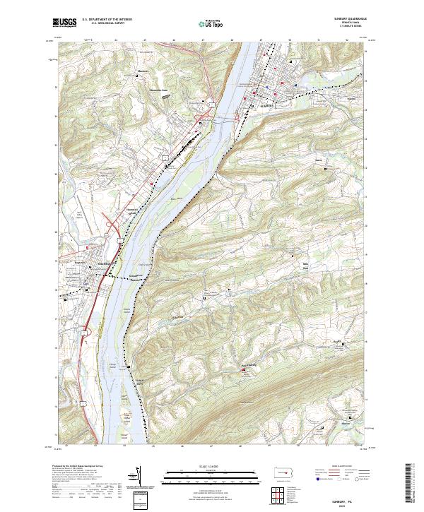
2023 Map of Sunbury
USGS Topo · Published 2023About this map
The Susquehanna River dominates the landscape at the confluence of Penns Creek, where the county seat of Sunbury sits across from the growing riverfront of Shamokin Dam. This 2023 survey details a region where river transport and settlement are inextricably linked, evidenced by the numerous islands like Byers Island and Cherry Island that break the channel. The map reveals a dense concentration of historical burial sites and civic landmarks, from the Northumberland County Courthouse in the city center to the Reformed Graveyard and Old Lutheran Cem in nearby Selinsgrove. Inland, the terrain rises toward Little Mountain, where small rural clusters like Patricksburg and Asherton maintain their identity along the winding courses of Bolle Run and Hallowing Run. The presence of the Susquehanna River Water Trail - Middle Section Trl highlights the river's modern role as a recreational corridor alongside its long history as a commercial artery.
Find a feature on this map
58 named features on this map. Tap any name to fly to it.
Don’t see what you’re looking for? This feature index may not catch every label — zoom into the map to look around manually.
Map Details
Editions of this 2023 Sunbury Map
This is the sole edition of this map. No revisions or reprints were ever made.
Other maps of this area

1892 · Lykens
USGS Topo · 1:62,500

1892 · Shamokin
USGS Topo · 1:62,500

1893 · Sunbury
USGS Topo · 1:62,500

1893 · Lykens
USGS Topo · 1:62,500

1893 · Shamokin
USGS Topo · 1:62,500

1893 · Millersburg
USGS Topo · 1:62,500

1943 · Millersburg
USGS Topo · 1:62,500

1943 · Lykens
USGS Topo · 1:62,500

1943 · Shamokin
USGS Topo · 1:62,500

1943 · Sunbury
USGS Topo · 1:62,500