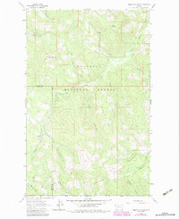
1963 Map of Sunday Mountain
USGS Topo · Published 1984About this map
Kootenai National Forest and Flathead National Forest dominate this high-altitude terrain, where the boundary between Lincoln Co and Flathead Co cuts through the steep ridges. The landscape is defined by a dense network of drainages, notably Sunday Creek and its many tributaries like Blessed Creek and Harvey Creek. A Lookout Tower sits atop Sunday Mountain, serving as a critical vantage point for forestry management in this timber-heavy region.
Find a feature on this map
21 named features on this map. Tap any name to fly to it.
Don’t see what you’re looking for? This feature index may not catch every label — zoom into the map to look around manually.
Map Details
Editions of this 1963 Sunday Mountain Map
3 editions found
Other maps of this area

1913 · Stryker
USGS Topo · 1:125,000

1916 · Stryker
USGS Topo · 1:125,000

1957 · Kalispell
USGS Topo · 1:250,000

1960 · Kalispell
USGS Topo · 1:250,000

1961 · Kalispell
USGS Topo · 1:250,000

1962 · Johnson Peak
USGS Topo · 1:24,000

1963 · Stryker
USGS Topo · 1:24,000
1963 · Skillet Mountain
USGS Topo · 1:24,000

1963 · Sunday Mountain
USGS Topo · 1:24,000
1963 · Edna Mountain
USGS Topo · 1:24,000