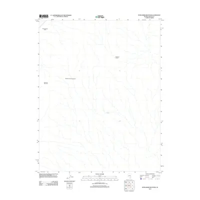
2012 Map of Sunflower Mountain
USGS Topo · Published 2012About this map
Sunflower Mountain stands as a prominent landmark in this desert landscape within the Meadow Valley Mountains range. This remote portion of Lincoln County, as documented by the U.S. Geological Survey in 2012, is characterized by a series of north-south ridges and dry drainage patterns that define the eastern edge of Kane Springs Valley. Human and animal activity in this arid environment often centers on vital water sources like Willow Spring, which provides a rare point of relief amidst the scrub and stone. To the northeast, the terrain is cut by the winding path of Hackberry Canyon. The map reveals a wilderness largely devoid of modern development, preserving the same topographic character encountered by earlier generations of western explorers and ranchers who navigated these high-desert valleys and canyons.
Find a feature on this map
5 named features on this map. Tap any name to fly to it.
Don’t see what you’re looking for? This feature index may not catch every label — zoom into the map to look around manually.
Map Details
Editions of this 2012 Sunflower Mountain Map
This is the sole edition of this map. No revisions or reprints were ever made.
Other maps of this area

1885 · Pioche
USGS Topo · 1:250,000

1886 · Saint Thomas
USGS Topo · 1:250,000

1886 · Pioche
USGS Topo · 1:250,000

1893 · Saint Thomas
USGS Topo · 1:250,000

1954 · Caliente
USGS Topo · 1:250,000

1954 · Las Vegas
USGS Topo · 1:250,000

1957 · Las Vegas
USGS Topo · 1:250,000

1959 · Caliente
USGS Topo · 1:250,000

1959 · Las Vegas
USGS Topo · 1:250,000

1962 · Las Vegas
USGS Topo · 1:250,000