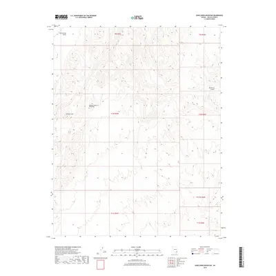
2018 Map of Sunflower Mountain
USGS Topo · Published 2018About this map
Sunflower Mtn serves as the central landmark in this high-desert portion of Lincoln County, situated within the wider Meadow Valley Mountains range. The terrain is characterized by the stark transition between the steep, ridged uplands and the broad, alluvial floor of the Kane Springs Valley to the northwest. This 2018 survey reveals an environment largely defined by natural topography and public land subdivisions, such as t10s r65e, with very little modern infrastructure or development. In the northeastern corner, the deep incision of Hackberry Canyon cuts through the mountains, illustrating the dramatic drainage patterns that shape this arid landscape. The map provides a detailed look at the complex contouring of the Meadow Valley range, offering a clear picture of the remote interior basin-and-range geography.
Find a feature on this map
11 named features on this map. Tap any name to fly to it.
Don’t see what you’re looking for? This feature index may not catch every label — zoom into the map to look around manually.
Map Details
Editions of this 2018 Sunflower Mountain Map
This is the sole edition of this map. No revisions or reprints were ever made.
Other maps of this area

1885 · Pioche
USGS Topo · 1:250,000

1886 · Saint Thomas
USGS Topo · 1:250,000

1886 · Pioche
USGS Topo · 1:250,000

1893 · Saint Thomas
USGS Topo · 1:250,000

1954 · Caliente
USGS Topo · 1:250,000

1954 · Las Vegas
USGS Topo · 1:250,000

1957 · Las Vegas
USGS Topo · 1:250,000

1959 · Caliente
USGS Topo · 1:250,000

1959 · Las Vegas
USGS Topo · 1:250,000

1962 · Las Vegas
USGS Topo · 1:250,000