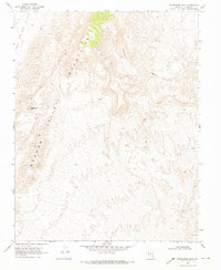
1969 Map of Sunflower Mtn
USGS Topo · Published 1973About this map
Sunflower Mtn serves as a central landmark in this high-desert region of Lincoln County during the late 1960s. The landscape is defined by the broad expanse of the Kane Springs Valley to the west and Meadow Valley to the southeast, separated by unnamed mountain ranges. Human activity is sparse, marked primarily by a single Jeep Trail winding through the northern terrain and a solitary prospect noted near the mountain foothills. This topographical study reflects the arid and undeveloped nature of the Great Basin, where transportation was limited to primitive routes and land use centered on minimal mineral exploration in isolated canyons like Hackberry Canyon.
Find a feature on this map
7 named features on this map. Tap any name to fly to it.
Don’t see what you’re looking for? This feature index may not catch every label — zoom into the map to look around manually.
Map Details
Editions of this 1969 Sunflower Mtn Map
This is the sole edition of this map. No revisions or reprints were ever made.
Other maps of this area

1885 · Pioche
USGS Topo · 1:250,000

1886 · Saint Thomas
USGS Topo · 1:250,000

1886 · Pioche
USGS Topo · 1:250,000

1893 · Saint Thomas
USGS Topo · 1:250,000

1954 · Caliente
USGS Topo · 1:250,000

1954 · Las Vegas
USGS Topo · 1:250,000

1957 · Las Vegas
USGS Topo · 1:250,000

1959 · Caliente
USGS Topo · 1:250,000

1959 · Las Vegas
USGS Topo · 1:250,000

1962 · Las Vegas
USGS Topo · 1:250,000