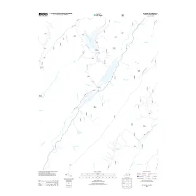
2013 Map of Sunrise
USGS Topo · Published 2013About this map
Sunrise sits along the banks of Back Cr in this rural pocket of Bath County, Virginia. The landscape is defined by its numerous named drainage patterns and hollows, including Joe Hollow and Dam Hollow, which feed into the central waterway. To the east, the Jackson River cuts through the terrain near Birch Run and Ned Hollow, while the higher elevations are marked by distinctively named peaks such as Mad Sheep, Mad Tom, and Berry Knob.
Find a feature on this map
45 named features on this map. Tap any name to fly to it.
Don’t see what you’re looking for? This feature index may not catch every label — zoom into the map to look around manually.
Map Details
Editions of this 2013 Sunrise Map
This is the sole edition of this map. No revisions or reprints were ever made.
Other maps of this area

1901 · Monterey
USGS Topo · 1:125,000

1922 · Cass
USGS Topo · 1:48,000

1923 · Warm Springs
USGS Topo · 1:48,000

1924 · Cass
USGS Topo · 1:62,500

1926 · Warm Springs
USGS Topo · 1:62,500

1930 · Warm Springs Run
USGS Topo · 1:24,000

1930 · Mountain Grove
USGS Topo · 1:24,000

1933 · Mountain Grove
USGS Topo · 1:31,680

1933 · Warm Springs Run
USGS Topo · 1:31,680

1941 · Monterey
USGS Topo · 1:62,500