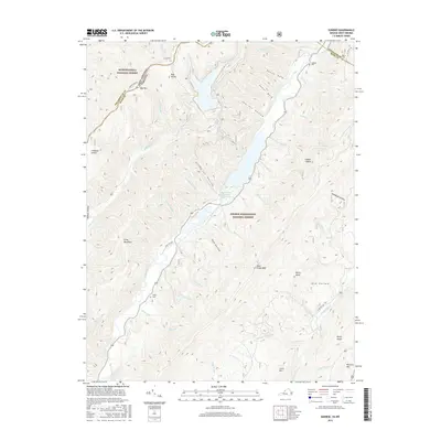
2016 Map of Sunrise
USGS Topo · Published 2016About this map
The Bath County Pumped Storage Lake dominates this mountain landscape, its waters contained within the high ridges of the Monongahela National Forest and the George Washington National Forest. The engineering of this reservoir is reflected in topographic details like Dam Hollow and Sawmill Run, which feed into the central basin. Genealogists will find several family-named burial grounds situated along the northern and central valleys, including Lightner Cem and Sively Cem, as well as Doyle Cem near the Highland County and Bath County border.
Find a feature on this map
57 named features on this map. Tap any name to fly to it.
Don’t see what you’re looking for? This feature index may not catch every label — zoom into the map to look around manually.
Map Details
Editions of this 2016 Sunrise Map
This is the sole edition of this map. No revisions or reprints were ever made.
Other maps of this area

1901 · Monterey
USGS Topo · 1:125,000

1922 · Cass
USGS Topo · 1:48,000

1923 · Warm Springs
USGS Topo · 1:48,000

1924 · Cass
USGS Topo · 1:62,500

1926 · Warm Springs
USGS Topo · 1:62,500

1930 · Warm Springs Run
USGS Topo · 1:24,000

1930 · Mountain Grove
USGS Topo · 1:24,000

1933 · Mountain Grove
USGS Topo · 1:31,680

1933 · Warm Springs Run
USGS Topo · 1:31,680

1941 · Monterey
USGS Topo · 1:62,500