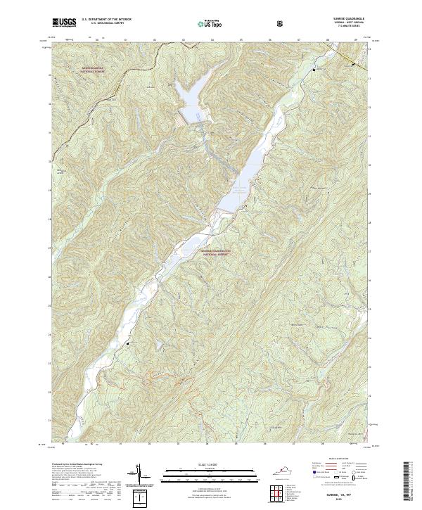
2022 Map of Sunrise
USGS Topo · Published 2022About this map
The Bath County Pumped Storage Lake dominates this mountain landscape along the border of Monongahela National Forest and George Washington National Forest. This modern survey illustrates the complex hydroelectric engineering integrated into the Alleghenies, where Back Creek and its many tributaries, such as Little Back Cr and Springhouse Run, are managed for power generation. Despite the industrial utility of the reservoir, the surrounding terrain remains defined by traditional family landmarks and burial grounds, including Lightner Cem and Sively Cem. The map tracks the passage of Back Creek Mtn and Little Mtn, showing how contemporary infrastructure like State Rte 600 follows the same natural contours used for generations. Local history is preserved in colorful place names such as Mad Sheep and Mad Tom, which sit high above the valleys and trails like the Jackson River Fishing Trl.
Find a feature on this map
65 named features on this map. Tap any name to fly to it.
Don’t see what you’re looking for? This feature index may not catch every label — zoom into the map to look around manually.
Map Details
Editions of this 2022 Sunrise Map
This is the sole edition of this map. No revisions or reprints were ever made.
Other maps of this area

1901 · Monterey
USGS Topo · 1:125,000

1922 · Cass
USGS Topo · 1:48,000

1923 · Warm Springs
USGS Topo · 1:48,000

1924 · Cass
USGS Topo · 1:62,500

1926 · Warm Springs
USGS Topo · 1:62,500

1930 · Warm Springs Run
USGS Topo · 1:24,000

1930 · Mountain Grove
USGS Topo · 1:24,000

1933 · Mountain Grove
USGS Topo · 1:31,680

1933 · Warm Springs Run
USGS Topo · 1:31,680

1941 · Monterey
USGS Topo · 1:62,500