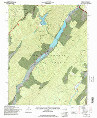
1995 Map of Sunrise
USGS Topo · Published 1998About this map
Back Creek dominates this rugged borderland where the George Washington National Forest and Monongahela National Forest converge. The landscape is defined by its industrial water management, featuring a prominent Dam and a Powerhouse that harness the valley's steep hydraulic potential. While much of the terrain is protected forest land, pockets of local history remain visible through family-named landmarks and resting places.
Find a feature on this map
49 named features on this map. Tap any name to fly to it.
Don’t see what you’re looking for? This feature index may not catch every label — zoom into the map to look around manually.
Map Details
Editions of this 1995 Sunrise Map
This is the sole edition of this map. No revisions or reprints were ever made.
Other maps of this area

1901 · Monterey
USGS Topo · 1:125,000

1922 · Cass
USGS Topo · 1:48,000

1923 · Warm Springs
USGS Topo · 1:48,000

1924 · Cass
USGS Topo · 1:62,500

1926 · Warm Springs
USGS Topo · 1:62,500

1930 · Warm Springs Run
USGS Topo · 1:24,000

1930 · Mountain Grove
USGS Topo · 1:24,000

1933 · Mountain Grove
USGS Topo · 1:31,680

1933 · Warm Springs Run
USGS Topo · 1:31,680

1941 · Monterey
USGS Topo · 1:62,500