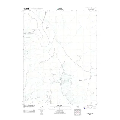
2011 Map of Sunrise Flat
USGS Topo · Published 2011About this map
Sunrise Flat and Calavada Flat dominate the central basin of this high-altitude landscape in Mineral County, defined by its critical water sources and mountain passes. The persistence of water in this arid environment is recorded through a series of named desert seeps, including York Spring, Stone Cabin Spring, and Buffington Spring. These features, alongside Dunbarton Spring, represent the essential stopping points for travelers and livestock moving through the basin. High points like Petrified Summit and Calavada Summit mark the transition between different drainage areas, while Muller Mountain and the southern Volcano Peak provide prominent navigational landmarks. The map illustrates a network of trails and unimproved roads that trace the natural contours of the basin, connecting these vital springs across the open flats.
Find a feature on this map
10 named features on this map. Tap any name to fly to it.
Don’t see what you’re looking for? This feature index may not catch every label — zoom into the map to look around manually.
Map Details
Editions of this 2011 Sunrise Flat Map
This is the sole edition of this map. No revisions or reprints were ever made.
Other maps of this area

1907 · Tonopah
USGS Topo · 1:250,000

1908 · Tonopah
USGS Topo · 1:250,000

1909 · Hawthorne
USGS Topo · 1:250,000

1911 · Hawthorne
USGS Topo · 1:250,000

1915 · Hawthorne
USGS Topo · 1:250,000

1948 · Walker Lake
USGS Topo · 1:250,000

1956 · Tonopah
USGS Topo · 1:250,000

1957 · Walker Lake
USGS Topo · 1:250,000

1959 · Tonopah
USGS Topo · 1:250,000

1962 · Walker Lake
USGS Topo · 1:250,000