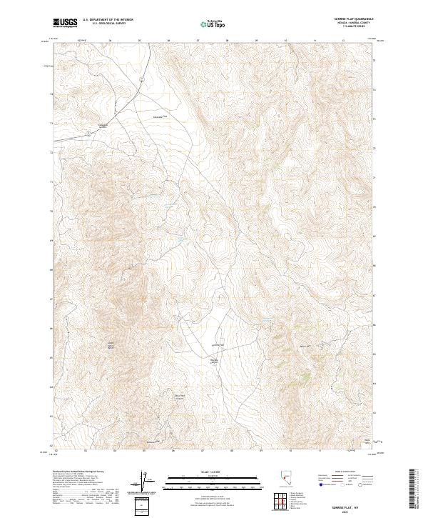
2021 Map of Sunrise Flat
USGS Topo · Published 2021About this map
York Spring and Stone Cabin Spring offer critical water points in this arid pocket of Mineral County, where the high desert terrain of the Gabbs Valley Range meets broad basins. The landscape is defined by the high elevations of Volcano Peak and Muller Mtn, which overlook the expansive desert floor of Sunrise Flat. This area is marked by a complex network of canyons and summits, including Volcano Canyon and New York Canyon, which cut through the mountain range. Historically significant for its isolated springs like Buffington Spring and Dunbarton Spring, the region reflects the typical Great Basin pattern of survival tied to these scarce water sources. Calavada Summit provides a natural pass through the northern reaches, connecting the lower Calavada Flat with the surrounding high-elevation peaks.
Find a feature on this map
18 named features on this map. Tap any name to fly to it.
Don’t see what you’re looking for? This feature index may not catch every label — zoom into the map to look around manually.
Map Details
Editions of this 2021 Sunrise Flat Map
This is the sole edition of this map. No revisions or reprints were ever made.
Other maps of this area

1907 · Tonopah
USGS Topo · 1:250,000

1908 · Tonopah
USGS Topo · 1:250,000

1909 · Hawthorne
USGS Topo · 1:250,000

1911 · Hawthorne
USGS Topo · 1:250,000

1915 · Hawthorne
USGS Topo · 1:250,000

1948 · Walker Lake
USGS Topo · 1:250,000

1956 · Tonopah
USGS Topo · 1:250,000

1957 · Walker Lake
USGS Topo · 1:250,000

1959 · Tonopah
USGS Topo · 1:250,000

1962 · Walker Lake
USGS Topo · 1:250,000