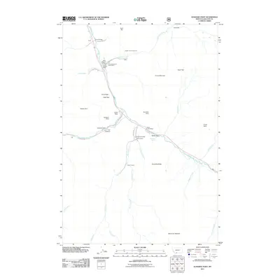
2011 Map of Sunshine Point
USGS Topo · Published 2011About this map
Gallatin River flows through this mountain landscape, carved by a network of drainage basins and distinct river-bend settlements. The area is defined by its historic ranching properties, including the Three Hundred and Twenty Ranch and the Covered Wagon Ranch, which sit along the river's path. Infrastructure for mountain travel is evident in the multiple river crossings such as Almart Bridge and Ruegemar Bridge. Higher elevations are marked by prominent features like Grouse Mountain and Sunshine Point, while specialized local routes like Walton Mine Rd suggest historical resource extraction. The map also captures several hydrological landmarks, from the Snowflake Springs in the Middle Basin to the confluence of Sage Creek and Big Spring Creek near the Seven-11 Ranch.
Find a feature on this map
43 named features on this map. Tap any name to fly to it.
Don’t see what you’re looking for? This feature index may not catch every label — zoom into the map to look around manually.
Map Details
Editions of this 2011 Sunshine Point Map
This is the sole edition of this map. No revisions or reprints were ever made.
Other maps of this area

1888 · Three Forks
USGS Topo · 1:250,000

1894 · Three Forks
USGS Topo · 1:250,000

1895 · Three Forks
USGS Topo · 1:250,000

1947 · Bozeman
USGS Topo · 1:250,000

1948 · Bozeman
USGS Topo · 1:250,000

1950 · Hebgen Dam
USGS Topo · 1:62,500

1950 · Sphinx Mountain
USGS Topo · 1:62,500

1955 · Bozeman
USGS Topo · 1:250,000

1955 · Crown Butte
USGS Topo · 1:62,500

1955 · Ashton
USGS Topo · 1:250,000