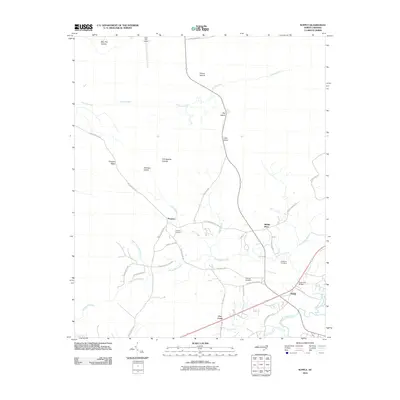
2010 Map of Supply
USGS Topo · Published 2010About this map
Lockwoods Folly River and its intricate network of tributaries define this coastal Brunswick County landscape, where low-lying wetlands like Royal Oak Swamp and Beaverdam Swamp separate the established settlements. The community of Supply serves as a central hub, connected to the surrounding countryside by a web of local roads such as Stone Chimney Rd SW and Big Macedonia Rd NW. The topography is dominated by subtle elevations and island formations within the marsh, including Prospect Ridge, Atkinson Island, and the Fall Swamp Islands. Historical and genealogical interest is found in the scattered burial grounds, specifically Prospect Cemetery near the community of Prospect and Galloway Cemetery located further east. Aviation activity is noted at the Bear Pen Airport, while the Royal Oak Bridge provides a key crossing over the swamp systems that characterize this riverine environment just inland from the Atlantic coast.
Find a feature on this map
47 named features on this map. Tap any name to fly to it.
Don’t see what you’re looking for? This feature index may not catch every label — zoom into the map to look around manually.
Map Details
Editions of this 2010 Supply Map
This is the sole edition of this map. No revisions or reprints were ever made.
Other maps of this area

1942 · Juniper Creek
USGS Topo · 1:24,000

1943 · Honey Island
USGS Topo · 1:24,000

1943 · Holden Beach
USGS Topo · 1:24,000

1943 · Exum
USGS Topo · 1:24,000

1943 · Bolivia
USGS Topo · 1:24,000

1943 · Lockwoods Folly
USGS Topo · 1:24,000

1943 · Supply
USGS Topo · 1:24,000

1943 · Lewis Swamp
USGS Topo · 1:24,000

1943 · Shallotte
USGS Topo · 1:24,000

1944 · Supply
USGS Topo · 1:31,680