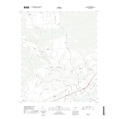
2019 Map of Supply
USGS Topo · Published 2019About this map
Green Swamp dominates the northern reaches of this coastal North Carolina landscape, where a network of islands like Big Island and Atkinson Island rise above the wetlands. The terrain is characterized by complex drainage systems, including Royal Oak Swamp and Beaverdam Swamp, which feed into the Lockwoods Folly River. The settlement pattern follows the higher ground along the southern and western margins, notably at Prospect and Supply. Local history is anchored by the Prospect Cem and Galloway Cem, providing valuable points of reference for genealogists tracing families in the Brunswick County area. Transport routes such as Makatoka Rd NW and Green Swamp Rd NW cut through the swampy lowlands, connecting small communities to the larger hub of Shallotte in the south, while the Royal Oak Bridge provides a key crossing near the eastern boundary.
Find a feature on this map
69 named features on this map. Tap any name to fly to it.
Don’t see what you’re looking for? This feature index may not catch every label — zoom into the map to look around manually.
Map Details
Editions of this 2019 Supply Map
This is the sole edition of this map. No revisions or reprints were ever made.
Other maps of this area

1942 · Juniper Creek
USGS Topo · 1:24,000

1943 · Honey Island
USGS Topo · 1:24,000

1943 · Holden Beach
USGS Topo · 1:24,000

1943 · Exum
USGS Topo · 1:24,000

1943 · Bolivia
USGS Topo · 1:24,000

1943 · Lockwoods Folly
USGS Topo · 1:24,000

1943 · Supply
USGS Topo · 1:24,000

1943 · Lewis Swamp
USGS Topo · 1:24,000

1943 · Shallotte
USGS Topo · 1:24,000

1944 · Supply
USGS Topo · 1:31,680