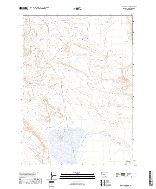
2023 Map of Surveyors Lake
USGS Topo · Published 2023About this map
Surveyors Lake and the seasonally fluctuating Shallow Lake define this high-desert basin in Harney County. The landscape is characterized by its isolation and subtle elevation changes, where primitive access routes like D L Spring Rd and Nat For Dev Rd 6176 navigate between volcanic landforms. The presence of Butcher Flat in the southeastern corner suggests a rare expanse of level ground amidst the undulating contours. This recent survey reflects the contemporary state of these remote water features, documenting the drainage patterns and access roads essential for managing public lands. Genealogists or historians interested in the grazing history of the Oregon interior will find these specific family-named or utilitarian landmarks useful for identifying historic range boundaries and water rights in a traditionally arid region.
Find a feature on this map
10 named features on this map. Tap any name to fly to it.
Don’t see what you’re looking for? This feature index may not catch every label — zoom into the map to look around manually.
Map Details
Editions of this 2023 Surveyors Lake Map
This is the sole edition of this map. No revisions or reprints were ever made.
Other maps of this area

1955 · Adel
USGS Topo · 1:250,000

1957 · Adel
USGS Topo · 1:250,000

1958 · Adel
USGS Topo · 1:250,000

1962 · Adel
USGS Topo · 1:250,000

1971 · Fish Fin Rim
USGS Topo · 1:24,000
1971 · Acty Mountain NW
USGS Topo · 1:24,000

1971 · Beatys Butte
USGS Topo · 1:24,000

1971 · Surveyors Lake
USGS Topo · 1:24,000

1971 · Coyote Gap SE
USGS Topo · 1:24,000

1971 · Mahogany Butte
USGS Topo · 1:24,000