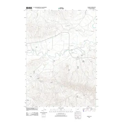
2012 Map of Sussex
USGS Topo · Published 2012About this map
Sussex serves as the focal point of this rangeland survey, where the meandering Powder River cuts a deep path through the high plains of Johnson County. The landscape is defined by its extensive drainage systems, including Center Draw, Deadman Draw, and the prominent West Carpenter Canyon. This era of land use is characterized by a network of established family ranching operations, such as the H Meike Ranch, Garrett Ranch, and Turk Ranch, which are positioned near reliable water sources like Fourmile Cr and Salt Cr. Notable geological landmarks like The Chimney and Chalk Butte provide vertical relief in an otherwise expansive terrain of draws and canyons. The settlement pattern follows the river valley, with the modest community of Sussex situated at a strategic crossing point where the winding river meets local transit routes like Lower Sussex Rd.
Find a feature on this map
30 named features on this map. Tap any name to fly to it.
Don’t see what you’re looking for? This feature index may not catch every label — zoom into the map to look around manually.
Map Details
Editions of this 2012 Sussex Map
This is the sole edition of this map. No revisions or reprints were ever made.
Other maps of this area

1953 · Fort Reno
USGS Topo · 1:24,000

1954 · House Creek
USGS Topo · 1:24,000

1954 · Linch
USGS Topo · 1:24,000

1955 · Arminto
USGS Topo · 1:250,000

1958 · Arminto
USGS Topo · 1:250,000

1961 · Soldier Creek
USGS Topo · 1:24,000

1961 · Fourmile Reservoir
USGS Topo · 1:24,000

1961 · Figure 8 Reservoir
USGS Topo · 1:24,000

1961 · Dugout Ranch
USGS Topo · 1:24,000

1961 · Dead Woman Crossing
USGS Topo · 1:24,000