
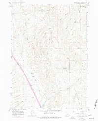
1961 Map of Dugout Ranch
USGS Topo · Published 1965About this map
Dugout Ranch and other isolated homesteads define this mid-century Wyoming landscape, showing the persistent ranching operations in Johnson County during the early 1960s. The terrain is deeply inscribed by a network of drainage channels, including North Spring Draw and West Monument Draw, reflecting a dry environment where water management is paramount. Functional infrastructure like the Aqueduct and Pipeline cross the territory, supporting livestock at locations such as O'Connor Ranch and Hull Ranch. Local hydrology is marked by the presence of Quinn Reservoir and a Flowing Well, while the nomenclature of the draws—such as Dogtown Draw and Lone Tree Gulch—hints at the specific landmarks used by ranchers to navigate this dissected plateau.
Find a feature on this map
24 named features on this map. Tap any name to fly to it.
Don’t see what you’re looking for? This feature index may not catch every label — zoom into the map to look around manually.
Map Details
Editions of this 1961 Dugout Ranch Map
2 editions found
Other maps of this area

1955 · Arminto
USGS Topo · 1:250,000

1958 · Arminto
USGS Topo · 1:250,000

1961 · Kaycee NE
USGS Topo · 1:24,000

1961 · Figure 8 Reservoir
USGS Topo · 1:24,000

1961 · Dead Woman Crossing
USGS Topo · 1:24,000

1961 · Wall Creek
USGS Topo · 1:24,000
1961 · Sussex
USGS Topo · 1:24,000

1962 · Arminto
USGS Topo · 1:250,000

1968 · Midwest
USGS Topo · 1:24,000

1968 · Salt Canyon
USGS Topo · 1:24,000