
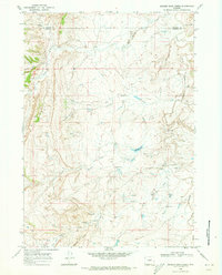
1968 Map of Salt Canyon
USGS Topo · Published 1973About this map
Tisdale Mountain dominates the northern reaches of this landscape, a prominent geological feature in the transition between the Big Horn Basin and the Powder River Basin. The terrain is marked by a complex network of draws and canyons, including Salt Canyon and the notable Devils Monument rock formation. In the late 1960s, the East Tisdale Oil Field was an active industrial presence on the mountain’s slopes, indicated by numerous gas and oil wells.
Find a feature on this map
36 named features on this map. Tap any name to fly to it.
Don’t see what you’re looking for? This feature index may not catch every label — zoom into the map to look around manually.
Map Details
Editions of this 1968 Salt Canyon Map
This is the sole edition of this map. No revisions or reprints were ever made.
Other maps of this area

1955 · Arminto
USGS Topo · 1:250,000

1958 · Arminto
USGS Topo · 1:250,000

1961 · TTT Ranch
USGS Topo · 1:24,000

1961 · Dugout Ranch
USGS Topo · 1:24,000

1961 · Wall Creek
USGS Topo · 1:24,000

1962 · Arminto
USGS Topo · 1:250,000

1968 · Big Gulch
USGS Topo · 1:24,000

1968 · Camel Hump Reservoir
USGS Topo · 1:24,000

1968 · Fiftymile Flat
USGS Topo · 1:24,000
1968 · Broken Horn Creek
USGS Topo · 1:24,000