
1968 Map of Fiftymile Flat
USGS Topo · Published 1972About this map
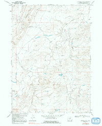
The South Fork Powder River and its intricate network of seasonal drainages define this high plains landscape in central Wyoming. This late 1960s survey documents a working cattle-country environment where remote landmarks like Jack Ellis Camp and the Powder River Corrals indicate the human presence in a wide-open terrain. The topography is marked by significant landforms such as Broken Horn and the prominent Blue Hill, while the namesake Fiftymile Flat stretches across the central portion of the quadrangle.
Find a feature on this map
27 named features on this map. Tap any name to fly to it.
Don’t see what you’re looking for? This feature index may not catch every label — zoom into the map to look around manually.
Map Details
Editions of this 1968 Fiftymile Flat Map
2 editions found
Other maps of this area

1955 · Arminto
USGS Topo · 1:250,000

1958 · Arminto
USGS Topo · 1:250,000

1962 · Arminto
USGS Topo · 1:250,000

1968 · Willow Creek School
USGS Topo · 1:24,000

1968 · Merino
USGS Topo · 1:24,000

1968 · Camel Hump Reservoir
USGS Topo · 1:24,000

1968 · Reynolds Reservoir
USGS Topo · 1:24,000

1968 · Big Sulfur Draw
USGS Topo · 1:24,000
1968 · Anderson Draw
USGS Topo · 1:24,000

1968 · Salt Canyon
USGS Topo · 1:24,000