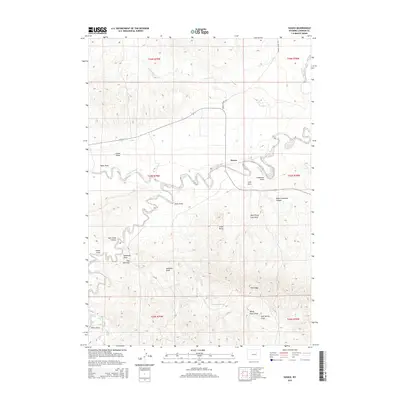
2015 Map of Sussex
USGS Topo · Published 2015About this map
Sussex serves as the central focal point in this Johnson County landscape, situated where the high plains meet the intricate winding of the Powder River. The river's serpentine path dominates the northern half of the sheet, creating a complex series of oxbows and bends that likely dictated the placement of early ranching infrastructure. To the south, the terrain becomes increasingly fractured by an extensive system of natural drainage features, most notably Deadman Draw, Jenks Draw, and Andrews Draw, which carve through the arid topography toward the high point at Chalk Butte. The nomenclature of the land reveals a legacy of local orientation, from the distinct formation known as The Chimney to the various named canyons such as West Carpenter Canyon. The presence of Patrick Reservoir and several named springs suggests the critical importance of water management in this high-altitude environment, while the path of Lower Sussex Rd provides the primary artery for movement through the basin.
Find a feature on this map
29 named features on this map. Tap any name to fly to it.
Don’t see what you’re looking for? This feature index may not catch every label — zoom into the map to look around manually.
Map Details
Editions of this 2015 Sussex Map
This is the sole edition of this map. No revisions or reprints were ever made.
Other maps of this area

1953 · Fort Reno
USGS Topo · 1:24,000

1954 · House Creek
USGS Topo · 1:24,000

1954 · Linch
USGS Topo · 1:24,000

1955 · Arminto
USGS Topo · 1:250,000

1958 · Arminto
USGS Topo · 1:250,000

1961 · Soldier Creek
USGS Topo · 1:24,000

1961 · Fourmile Reservoir
USGS Topo · 1:24,000

1961 · Figure 8 Reservoir
USGS Topo · 1:24,000

1961 · Dugout Ranch
USGS Topo · 1:24,000

1961 · Dead Woman Crossing
USGS Topo · 1:24,000