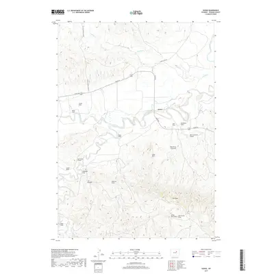
2017 Map of Sussex
USGS Topo · Published 2017About this map
Sussex sits at a geographic transition where the meandering Powder River cuts through the high plains of Johnson County. The settlement is anchored by the junction of Sussex Rd and the Buffalo Sussex Cutoff Rd, serving as a hub for the surrounding ranching and drainage networks. To the south, the terrain becomes increasingly complex, marked by prominent landmarks such as The Chimney and the elevated stretch of Pine Ridge. The landscape is defined by an intricate system of seasonal watercourses and draws, including Salt Cr and Fourmile Cr, which have carved distinctive features like Chalk Butte and Salt Creek V Draw. This 2017 survey illustrates the enduring rural character of the region, where wide-open spaces are segmented by township lines and traditional access routes through rugged canyons like West Carpenter Canyon.
Find a feature on this map
29 named features on this map. Tap any name to fly to it.
Don’t see what you’re looking for? This feature index may not catch every label — zoom into the map to look around manually.
Map Details
Editions of this 2017 Sussex Map
This is the sole edition of this map. No revisions or reprints were ever made.
Other maps of this area

1953 · Fort Reno
USGS Topo · 1:24,000

1954 · House Creek
USGS Topo · 1:24,000

1954 · Linch
USGS Topo · 1:24,000

1955 · Arminto
USGS Topo · 1:250,000

1958 · Arminto
USGS Topo · 1:250,000

1961 · Soldier Creek
USGS Topo · 1:24,000

1961 · Fourmile Reservoir
USGS Topo · 1:24,000

1961 · Figure 8 Reservoir
USGS Topo · 1:24,000

1961 · Dugout Ranch
USGS Topo · 1:24,000

1961 · Dead Woman Crossing
USGS Topo · 1:24,000