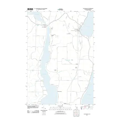
2011 Map of Suttons Bay
USGS Topo · Published 2011About this map
Suttons Bay serves as a focal point on the eastern shore of the Leelanau Peninsula, where the village and its Suttons Bay Post Office face the waters of the West Arm Grand Traverse Bay. To the west, the elongated basin of Lake Leelanau dominates the interior, punctuated by the narrow narrows at the village of Lake Leelanau. This area is characterized by a mix of established lakeside communities and agricultural land, with several historic burial grounds including the Norwegian Lutheran Cemetery and Saint Marys Cemetery providing important touchstones for local genealogy. The presence of the Leelanau Trl cutting through the landscape suggests the conversion of former rail corridors into modern recreational paths, while smaller settlements like Keswick and Bingham mark the rural intersections that have defined the township's interior for generations.
Find a feature on this map
93 named features on this map. Tap any name to fly to it.
Don’t see what you’re looking for? This feature index may not catch every label — zoom into the map to look around manually.
Map Details
Editions of this 2011 Suttons Bay Map
This is the sole edition of this map. No revisions or reprints were ever made.
Other maps of this area

1954 · Traverse City
USGS Topo · 1:250,000

1955 · Cheboygan
USGS Topo · 1:250,000

1957 · Traverse City
USGS Topo · 1:62,500

1957 · Northport
USGS Topo · 1:62,500

1957 · Maple City
USGS Topo · 1:62,500

1958 · Cheboygan
USGS Topo · 1:250,000

1958 · Traverse City
USGS Topo · 1:250,000

1983 · Omena
USGS Topo · 1:24,000

1983 · Maple City
USGS Topo · 1:24,000

1983 · Traverse City SE
USGS Topo · 1:25,000