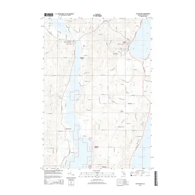
2014 Map of Suttons Bay
USGS Topo · Published 2014About this map
Suttons Bay and its sheltered harbor define the northeastern shoreline of this Leelanau County survey, where the village and its nearby Saint Michael Cem overlook the West Arm Grand Traverse Bay. To the west, the elongated waters of Lake Leelanau stretch across the landscape, connected to the smaller Provemont Pond near the settlement of Lake Leelanau. The geography here is marked by narrow ridges and drainages like Merbert Cr and Lee Cr that flow toward the larger basins.
Find a feature on this map
117 named features on this map. Tap any name to fly to it.
Don’t see what you’re looking for? This feature index may not catch every label — zoom into the map to look around manually.
Map Details
Editions of this 2014 Suttons Bay Map
This is the sole edition of this map. No revisions or reprints were ever made.
Other maps of this area

1954 · Traverse City
USGS Topo · 1:250,000

1955 · Cheboygan
USGS Topo · 1:250,000

1957 · Traverse City
USGS Topo · 1:62,500

1957 · Northport
USGS Topo · 1:62,500

1957 · Maple City
USGS Topo · 1:62,500

1958 · Cheboygan
USGS Topo · 1:250,000

1958 · Traverse City
USGS Topo · 1:250,000

1983 · Omena
USGS Topo · 1:24,000

1983 · Maple City
USGS Topo · 1:24,000

1983 · Traverse City SE
USGS Topo · 1:25,000