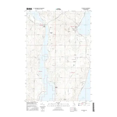
2017 Map of Suttons Bay
USGS Topo · Published 2017About this map
Suttons Bay serves as the focal point of this coastal landscape, situated along the West Arm Grand Traverse Bay of Lake Michigan. The interior is defined by the elongated profile of Lake Leelanau, which stretches through the center of the quadrangle. This 2017 survey shows a pattern of rural settlements and shorefront developments, including Fountain Point and Leelanau Shores. Genealogists will find a significant concentration of local cemeteries, such as the Norwegian Lutheran Cem, Saint Michael Cem, and Maple Grove Cem, reflecting the area's diverse cultural heritage. Small inland hubs like Keswick and Bingham are linked by a network of county roads, while natural drainage features like Leo Cr and Mebert Cr flow toward the larger basins, illustrating the local topography's influence on transportation and land use in this northern Michigan peninsula.
Find a feature on this map
117 named features on this map. Tap any name to fly to it.
Don’t see what you’re looking for? This feature index may not catch every label — zoom into the map to look around manually.
Map Details
Editions of this 2017 Suttons Bay Map
This is the sole edition of this map. No revisions or reprints were ever made.
Other maps of this area

1954 · Traverse City
USGS Topo · 1:250,000

1955 · Cheboygan
USGS Topo · 1:250,000

1957 · Traverse City
USGS Topo · 1:62,500

1957 · Northport
USGS Topo · 1:62,500

1957 · Maple City
USGS Topo · 1:62,500

1958 · Cheboygan
USGS Topo · 1:250,000

1958 · Traverse City
USGS Topo · 1:250,000

1983 · Omena
USGS Topo · 1:24,000

1983 · Maple City
USGS Topo · 1:24,000

1983 · Traverse City SE
USGS Topo · 1:25,000