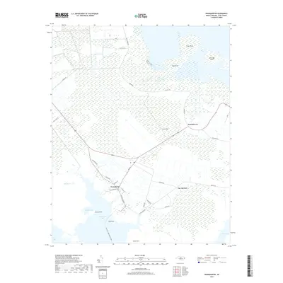
2019 Map of Swanquarter
USGS Topo · Published 2019About this map
The coastal village of Swanquarter serves as the focal point of this Hyde County landscape, where the terrestrial world meets the expansive waters of Swanquarter Bay. The community is defined by its maritime connections, notably the Ocracoke - Swan Quarter Ferry terminal which links this mainland reach to the Outer Banks. Low-lying terrain and intricate wetlands dominate the area, with named high ground like Buck Ridge and Tapping Hill providing contrast to the surrounding marshes.
Find a feature on this map
33 named features on this map. Tap any name to fly to it.
Don’t see what you’re looking for? This feature index may not catch every label — zoom into the map to look around manually.
Map Details
Editions of this 2019 Swanquarter Map
This is the sole edition of this map. No revisions or reprints were ever made.
Other maps of this area

1943 · Columbia
USGS Topo · 1:125,000
1951 · Bluff Point
USGS Topo · 1:24,000

1951 · Pamlico Point
USGS Topo · 1:24,000

1951 · Great Island
USGS Topo · 1:24,000

1951 · Scranton
USGS Topo · 1:24,000

1951 · New Holland
USGS Topo · 1:24,000

1951 · Swanquarter
USGS Topo · 1:24,000

1951 · Fairfield
USGS Topo · 1:24,000

1951 · Ponzer
USGS Topo · 1:24,000

1951 · New Lake SE
USGS Topo · 1:24,000