
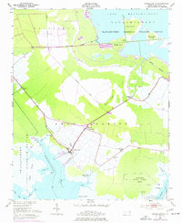
1951 Map of Swanquarter
USGS Topo · Published 1953About this map
Swanquarter serves as the focal point of this coastal Hyde County landscape, situated where the low-lying mainland meets the complex wetlands of Swanquarter Bay. The geography is defined by a sophisticated network of drainage and transport, including the Rose Bay Canal and Boundary Canal, which navigate the transition between the agricultural lands of Buck Ridge and the protected wilderness of the Mattamuskeet National Wildlife Refuge.
Find a feature on this map
37 named features on this map. Tap any name to fly to it.
Don’t see what you’re looking for? This feature index may not catch every label — zoom into the map to look around manually.
Map Details
Editions of this 1951 Swanquarter Map
2 editions found
Other maps of this area

1943 · Columbia
USGS Topo · 1:125,000
1951 · Bluff Point
USGS Topo · 1:24,000

1951 · Pamlico Point
USGS Topo · 1:24,000

1951 · Great Island
USGS Topo · 1:24,000

1951 · Scranton
USGS Topo · 1:24,000

1951 · New Holland
USGS Topo · 1:24,000

1951 · Fairfield
USGS Topo · 1:24,000

1951 · Ponzer
USGS Topo · 1:24,000

1951 · New Lake SE
USGS Topo · 1:24,000

1953 · Rocky Mount
USGS Topo · 1:250,000