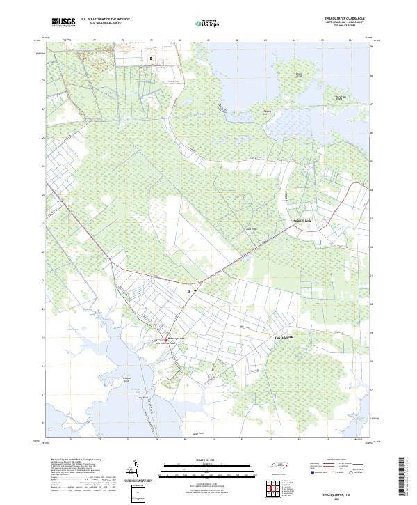
2022 Map of Swanquarter
USGS Topo · Published 2022About this map
Swanquarter serves as the focal point of this coastal Hyde County landscape, where the land meets the expansive waters of Swanquarter Bay. The village layout is defined by historical corridors like Main St and Church St, anchored by the Hyde County Courthouse. This 2022 survey illustrates the critical maritime connections of the region, specifically the Ocracoke - Swan Quarter Ferry route that links this mainland settlement to the Outer Banks. The surrounding terrain is a complex of wetlands and ridges, including the prominent Buck Ridge and low-lying reaches of Judith Marsh. Smaller inland junctions like Swindell Fork and Tiny Oak Fork suggest the persistent rural settlement patterns of the North Carolina tidewater. Human modification of the environment is evident in the straight course of the Rose Bay Canal, which cuts through the marshes toward the upper reaches of the map near Great Island.
Find a feature on this map
37 named features on this map. Tap any name to fly to it.
Don’t see what you’re looking for? This feature index may not catch every label — zoom into the map to look around manually.
Map Details
Editions of this 2022 Swanquarter Map
This is the sole edition of this map. No revisions or reprints were ever made.
Other maps of this area

1943 · Columbia
USGS Topo · 1:125,000
1951 · Bluff Point
USGS Topo · 1:24,000

1951 · Pamlico Point
USGS Topo · 1:24,000

1951 · Great Island
USGS Topo · 1:24,000

1951 · Scranton
USGS Topo · 1:24,000

1951 · New Holland
USGS Topo · 1:24,000

1951 · Swanquarter
USGS Topo · 1:24,000

1951 · Fairfield
USGS Topo · 1:24,000

1951 · Ponzer
USGS Topo · 1:24,000

1951 · New Lake SE
USGS Topo · 1:24,000