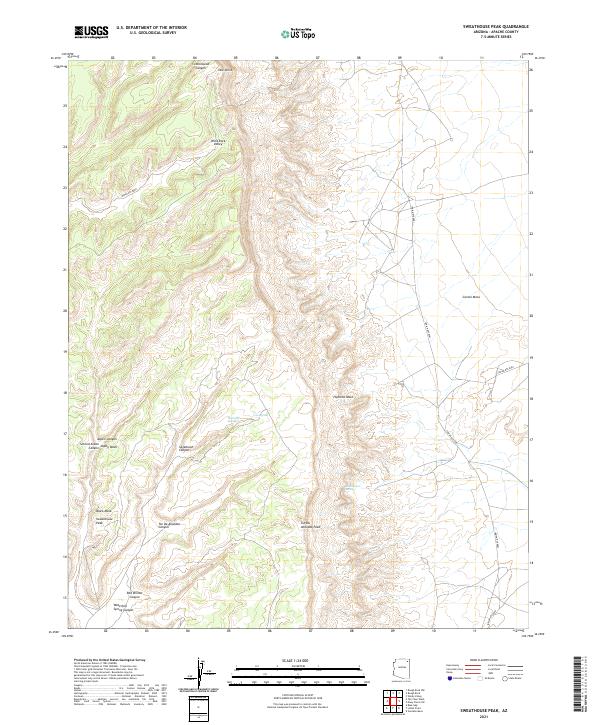
2021 Map of Sweathouse Peak
USGS Topo · Published 2021About this map
Sweathouse Peak and the high desert plateaus of Apache County are captured in this topographical study, revealing a landscape defined by deep erosional canyons and prominent mesas. The terrain is marked by significant verticality, ranging from the heights of Yale Point and Tse Da Ahoodzo Peak down to the drainage systems of Red Willow Canyon and Cottonwood Canyon. These natural features dominate the region, which is largely accessed by a network of tribal routes including Indian Rte 8081 and Indian Rte 8088.
Find a feature on this map
26 named features on this map. Tap any name to fly to it.
Don’t see what you’re looking for? This feature index may not catch every label — zoom into the map to look around manually.
Map Details
Editions of this 2021 Sweathouse Peak Map
This is the sole edition of this map. No revisions or reprints were ever made.
Other maps of this area

1892 · Canyon De Chelly
USGS Topo · 1:250,000

1954 · Shiprock
USGS Topo · 1:250,000

1958 · Shiprock
USGS Topo · 1:250,000

1959 · Shiprock
USGS Topo · 1:250,000

1968 · Tah Chee Wash
USGS Topo · 1:24,000

1968 · Many Farms SW
USGS Topo · 1:24,000

1968 · Windy Valley
USGS Topo · 1:24,000
1968 · Rough Rock
USGS Topo · 1:24,000
1968 · Rough Rock NW
USGS Topo · 1:24,000
1968 · Sweathouse Peak
USGS Topo · 1:24,000