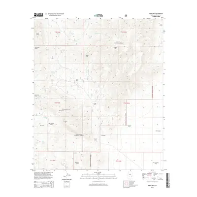
2014 Map of Swede Peak
USGS Topo · Published 2014About this map
Coronado National Forest defines the character of this landscape in the southeastern corner of Arizona, where the Chiricahua Mountains rise above the surrounding basins. The high terrain is marked by prominent summits like Swede Peak, Sunset Peak, and Limestone Mtn. This area serves as a critical watershed, evidenced by the numerous springs and tanks used for water management in a dry environment, including High Lonesome Spring, Cottonwood Corral Spring, and Saner Spring.
Find a feature on this map
42 named features on this map. Tap any name to fly to it.
Don’t see what you’re looking for? This feature index may not catch every label — zoom into the map to look around manually.
Map Details
Editions of this 2014 Swede Peak Map
This is the sole edition of this map. No revisions or reprints were ever made.
Other maps of this area

1917 · Chiricahua
USGS Topo · 1:125,000

1919 · Chiricahua
USGS Topo · 1:125,000

1926 · Rodeo
USGS Topo · 1:62,500

1926 · Rucker
USGS Topo · 1:62,500

1926 · Pedregosa
USGS Topo · 1:62,500

1940 · Apache
USGS Topo · 1:62,500

1955 · Douglas
USGS Topo · 1:250,000

1958 · Chiricahua Peak
USGS Topo · 1:62,500

1958 · Apache
USGS Topo · 1:62,500
1958 · Pedregosa Mountains
USGS Topo · 1:62,500