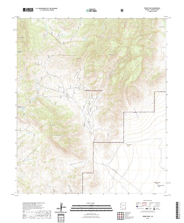
2021 Map of Swede Peak
USGS Topo · Published 2021About this map
The high ridges of the Chiricahua Mountains dominate this 2021 survey, where the rugged topography is defined by prominent summits such as Swede Peak and Sunset Peak. Managed largely as part of the Coronado National Forest, the landscape is a network of deep drainages including Tex Canyon and Shake Gulch that spill out toward the San Simon Valley to the east. Historically significant water sources like Cottonwood Spring, High Lonesome Spring, and Sunset Spring are critical landmarks in this arid environment, often serving as the primary waypoints for the remote trail systems that traverse the peaks.
Find a feature on this map
45 named features on this map. Tap any name to fly to it.
Don’t see what you’re looking for? This feature index may not catch every label — zoom into the map to look around manually.
Map Details
Editions of this 2021 Swede Peak Map
This is the sole edition of this map. No revisions or reprints were ever made.
Other maps of this area

1917 · Chiricahua
USGS Topo · 1:125,000

1919 · Chiricahua
USGS Topo · 1:125,000

1926 · Rodeo
USGS Topo · 1:62,500

1926 · Rucker
USGS Topo · 1:62,500

1926 · Pedregosa
USGS Topo · 1:62,500

1940 · Apache
USGS Topo · 1:62,500

1955 · Douglas
USGS Topo · 1:250,000

1958 · Chiricahua Peak
USGS Topo · 1:62,500

1958 · Apache
USGS Topo · 1:62,500
1958 · Pedregosa Mountains
USGS Topo · 1:62,500