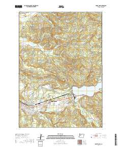
2020 Map of Sweet Home
USGS Topo · Published 2020About this map
The South Santiam River flows through the heart of this Linn County landscape, anchoring the city of Sweet Home and the adjacent community of Foster. The local economy's ties to the timber industry are evidenced by the presence of the Willamette Log Pond and the expansive Foster Lake. Further north, the terrain transitions into the elevations of Marks Ridge, North Butte, and Hogback Ridge, where numerous small creeks like McDowell Cr and Hamilton Cr carve through the foothills. Genealogists and local historians can find several established burial grounds scattered across the valley and surrounding hills, including Powell Cem, Ames Cem, Gilliland Cem, and Wiley Cem. Small settlements and naming conventions such as Lower Pleasant Valley and Berlin reflect a pattern of rural development focused along the river and the base of the Cascades.
Find a feature on this map
86 named features on this map. Tap any name to fly to it.
Don’t see what you’re looking for? This feature index may not catch every label — zoom into the map to look around manually.
Map Details
Editions of this 2020 Sweet Home Map
This is the sole edition of this map. No revisions or reprints were ever made.
Other maps of this area

1921 · Brownsville
USGS Topo · 1:62,500

1921 · Lebanon
USGS Topo · 1:62,500

1922 · Lebanon
USGS Topo · 1:48,000

1924 · Lebanon
USGS Topo · 1:62,500

1940 · Lebanon
USGS Topo · 1:62,500

1944 · Lebanon
USGS Topo · 1:62,500

1950 · Brownsville
USGS Topo · 1:62,500

1951 · Sweet Home
USGS Topo · 1:62,500

1951 · Snow Peak
USGS Topo · 1:62,500

1952 · Brownsville
USGS Topo · 1:62,500