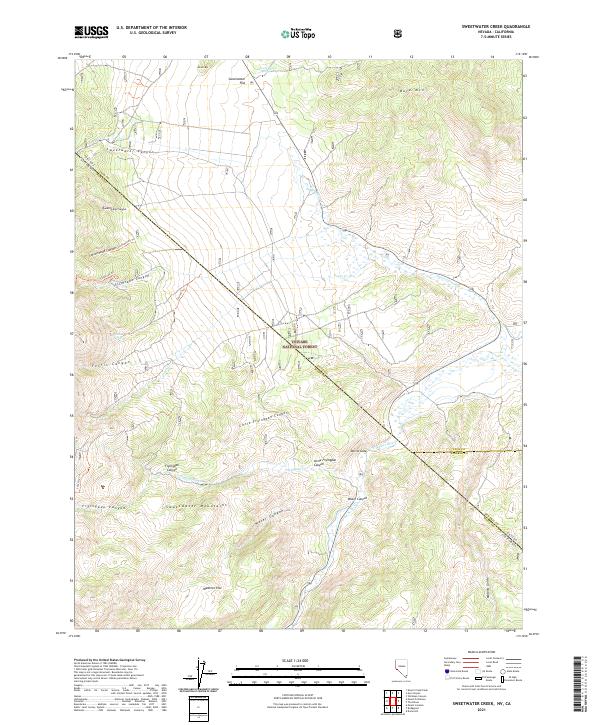
2021 Map of Sweetwater Creek
USGS Topo · Published 2021About this map
The Sweetwater Mountains dominate the high-altitude landscape of this 2021 survey, straddling the border between Lyon County, Nevada, and Mono County, California. This high-desert terrain is defined by a network of drainage systems and alluvial basins, including Sweetwater Flat and Wedertz Flat. The E Walker River cuts through the eastern portion of the quadrangle, joined by seasonal flows from Sweetwater Cr and Fryingpan Cr. The presence of Devils Gate and Masonic Gulch points to the area's history of movement through the mountain passes. Within the Toiyabe National Forest, numerous canyons such as Sweetwater Canyon and Silverado Canyon suggest a legacy of prospecting and grazing. Water sources like Long Doctor Spring remain vital markers in this arid environment, where peak elevations like Bald Mtn and Round Mtn provide significant landmarks for navigation across the state line.
Find a feature on this map
34 named features on this map. Tap any name to fly to it.
Don’t see what you’re looking for? This feature index may not catch every label — zoom into the map to look around manually.
Map Details
Editions of this 2021 Sweetwater Creek Map
This is the sole edition of this map. No revisions or reprints were ever made.
Other maps of this area

1891 · Wellington
USGS Topo · 1:125,000

1893 · Wellington
USGS Topo · 1:125,000

1909 · Bridgeport
USGS Topo · 1:125,000

1911 · Bridgeport
USGS Topo · 1:125,000

1920 · Bridgeport
USGS Topo · 1:125,000

1948 · Walker Lake
USGS Topo · 1:250,000

1956 · Desert Creek Peak
USGS Topo · 1:62,500

1956 · Fales Hot Springs
USGS Topo · 1:62,500

1957 · Walker Lake
USGS Topo · 1:250,000
1958 · Bridgeport
USGS Topo · 1:62,500