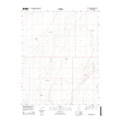
2014 Map of Sweetwater Mesa
USGS Topo · Published 2014About this map
Sweetwater Mesa and the expansive White Rock Mesa dominate this high-desert landscape in northern Apache County during the mid-2010s. This region of the Navajo Nation is defined by its dramatic topographic relief and a sparse network of Bureau of Indian Affairs routes, including Bia-18 and Bia-59. The drainage patterns are clearly marked by Burro Wash, which cuts through the arid terrain. Notable landmarks like the Three Black Rocks serve as significant navigational points within the township and range survey system. This map illustrates the contemporary state of land management and rural infrastructure, documenting the intersection of natural geologic formations with the critical transportation corridors that connect isolated settlements across the Colorado Plateau.
Find a feature on this map
11 named features on this map. Tap any name to fly to it.
Don’t see what you’re looking for? This feature index may not catch every label — zoom into the map to look around manually.
Map Details
Editions of this 2014 Sweetwater Mesa Map
This is the sole edition of this map. No revisions or reprints were ever made.
Other maps of this area

1883 · Marsh Pass
USGS Topo · 1:250,000

1892 · Marsh Pass
USGS Topo · 1:250,000

1892 · Canyon De Chelly
USGS Topo · 1:250,000

1954 · Shiprock
USGS Topo · 1:250,000

1956 · Marble Canyon
USGS Topo · 1:250,000

1958 · Shiprock
USGS Topo · 1:250,000

1959 · Shiprock
USGS Topo · 1:250,000

1959 · Marble Canyon
USGS Topo · 1:250,000

1961 · Marble Canyon
USGS Topo · 1:250,000
1968 · Chilchinbito
USGS Topo · 1:24,000