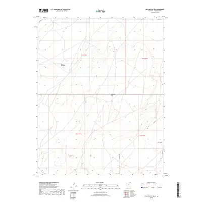
2018 Map of Sweetwater Mesa
USGS Topo · Published 2018About this map
White Rock Mesa and Sweetwater Mesa define this high-altitude landscape in the northeast corner of Arizona. This 2018 survey reveals a terrain dominated by significant geological formations and drainage networks, most notably Al Tse Toh and the southeastern drainage of Burro Wash. The map documents a sparse but vital transportation network consisting of tribal routes like Indian Rte 18 and Indian Rte 594. Beyond the expansive plateaus, distinct landmarks such as Three Black Rocks provide orientation in an area primarily organized by township and range boundaries. This modern record serves as a precise digital-era reference for the topographical features of Apache County, tracing the relationship between these massive mesas and the seasonal waterways that carve through them.
Find a feature on this map
12 named features on this map. Tap any name to fly to it.
Don’t see what you’re looking for? This feature index may not catch every label — zoom into the map to look around manually.
Map Details
Editions of this 2018 Sweetwater Mesa Map
This is the sole edition of this map. No revisions or reprints were ever made.
Other maps of this area

1883 · Marsh Pass
USGS Topo · 1:250,000

1892 · Marsh Pass
USGS Topo · 1:250,000

1892 · Canyon De Chelly
USGS Topo · 1:250,000

1954 · Shiprock
USGS Topo · 1:250,000

1956 · Marble Canyon
USGS Topo · 1:250,000

1958 · Shiprock
USGS Topo · 1:250,000

1959 · Shiprock
USGS Topo · 1:250,000

1959 · Marble Canyon
USGS Topo · 1:250,000

1961 · Marble Canyon
USGS Topo · 1:250,000
1968 · Chilchinbito
USGS Topo · 1:24,000