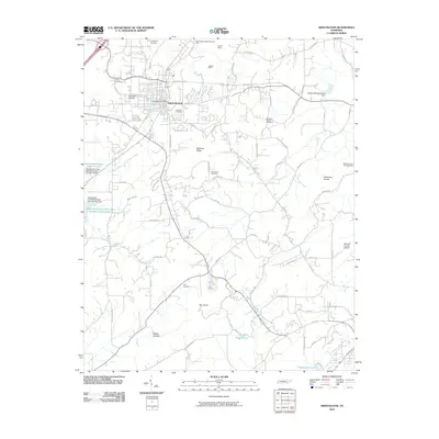
2010 Map of Sweetwater
USGS Topo · Published 2010About this map
The town of Sweetwater serves as the focal point for this Monroe County survey, situated along the valley of Sweetwater Creek. The landscape transition from the town center to the surrounding ridges is marked by industrial and agricultural history, visible through sites like the Ewing Mine and Heiskell Mine to the north. For genealogists, the map is a significant record of local family history, noting numerous burial grounds such as West View Cemetery, Heiskell Cemetery, and Forkners Chapel Cemetery. The eastern terrain is defined by the Hiwassee Knobs and Blackoak Ridge, while infrastructure like the Monroe County Airport and the Madisonville Lookout Tower indicate the 21st-century development of the region. Water resources are prominent throughout, including Cannon Spring and the complex of reservoirs like Sweetwater Creek Watershed Number One Reservoir.
Find a feature on this map
78 named features on this map. Tap any name to fly to it.
Don’t see what you’re looking for? This feature index may not catch every label — zoom into the map to look around manually.
Map Details
Editions of this 2010 Sweetwater Map
This is the sole edition of this map. No revisions or reprints were ever made.
Other maps of this area

1886 · Cleveland
USGS Topo · 1:125,000

1887 · Kingston
USGS Topo · 1:125,000

1891 · Kingston
USGS Topo · 1:125,000

1892 · Cleveland
USGS Topo · 1:125,000

1893 · Murphy
USGS Topo · 1:125,000

1893 · Kingston
USGS Topo · 1:125,000

1895 · Cleveland
USGS Topo · 1:125,000

1895 · Loudon
USGS Topo · 1:125,000

1901 · Cleveland
USGS Topo · 1:125,000

1914 · Murphy
USGS Topo · 1:125,000