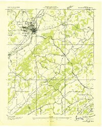
1936 Map of Sweetwater
USGS Topo · Published 1936About this map
Sweetwater anchors this 1936 survey, where the Lee Highway and the Southern railroad intersect to form a vital regional hub. The map captures the landscape during the early years of the Tennessee Valley Authority, showing the dense network of rural schools and churches that defined East Tennessee social life between the world wars. Notable institutions like the Tennessee Military Institute stand near the town center, while the surrounding countryside is dotted with community landmarks such as Forkner Chapel, Lees Ch, and New Bethany Ch.
Find a feature on this map
38 named features on this map. Tap any name to fly to it.
Don’t see what you’re looking for? This feature index may not catch every label — zoom into the map to look around manually.
Map Details
Editions of this 1936 Sweetwater Map
This is the sole edition of this map. No revisions or reprints were ever made.
Other maps of this area

1886 · Cleveland
USGS Topo · 1:125,000

1887 · Kingston
USGS Topo · 1:125,000

1891 · Kingston
USGS Topo · 1:125,000

1892 · Cleveland
USGS Topo · 1:125,000

1893 · Murphy
USGS Topo · 1:125,000

1893 · Kingston
USGS Topo · 1:125,000

1895 · Cleveland
USGS Topo · 1:125,000

1895 · Loudon
USGS Topo · 1:125,000

1901 · Cleveland
USGS Topo · 1:125,000

1914 · Murphy
USGS Topo · 1:125,000