
1981 Map of Swett
USGS Topo · Published 1981About this map
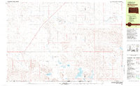
Bennett County ranchland and river valleys define this 1981 survey of the High Plains, centered on the small settlement of Swett. The landscape is dominated by the winding course of the White River and the Little White River to the south, while Bear-in-the-Lodge Creek drains the northern reaches. This map illustrates the sparse, rural infrastructure of the era, where isolated landmarks like a Storage Bin or a Radio Tower serve as essential navigational points across the open terrain.
Find a feature on this map
11 named features on this map. Tap any name to fly to it.
Don’t see what you’re looking for? This feature index may not catch every label — zoom into the map to look around manually.
Map Details
Editions of this 1981 Swett Map
This is the sole edition of this map. No revisions or reprints were ever made.
Other maps of this area

1955 · Hot Springs
USGS Topo · 1:250,000

1955 · Martin
USGS Topo · 1:250,000

1958 · Martin
USGS Topo · 1:250,000
1981 · Wakpamani
USGS Topo · 1:25,000

1981 · Patricia
USGS Topo · 1:25,000

1981 · Phantom Lake
USGS Topo · 1:25,000

1981 · Yellow Bear Camp
USGS Topo · 1:25,000

1981 · Martin
USGS Topo · 1:25,000

1981 · Allen
USGS Topo · 1:25,000

1981 · Ecoffey Lake
USGS Topo · 1:25,000