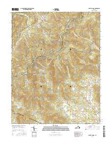
2016 Map of Swift Run Gap
USGS Topo · Published 2016About this map
Shenandoah National Park and the high ridges of the Blue Ridge dominate this modern survey, where the Appalachian National Scenic Trail winds through historic passes like Swift Run Gap and Smith Roach Gap. The landscape is a complex network of hollows and mountains, including Bacon Hollow, Shiffett Hollow, and Brokenback Mtn, illustrating the dramatic elevation changes that shaped local settlement patterns. Small communities such as Beldor, Sandy Bottom, and Dyke sit at the mountain feet, connected by the Spotswood Trl and Skyline Dr. Genealogists may find value in the scattered burial sites like Temple Hill Cem and Mission Home Cem, which remain as markers of family history in these rural gaps. The survey also tracks the headwaters of the Roach River and Lynch River as they descend from the steep eastern slopes.
Find a feature on this map
101 named features on this map. Tap any name to fly to it.
Don’t see what you’re looking for? This feature index may not catch every label — zoom into the map to look around manually.
Map Details
Editions of this 2016 Swift Run Gap Map
This is the sole edition of this map. No revisions or reprints were ever made.
Other maps of this area

1892 · Gordonsville
USGS Topo · 1:125,000

1892 · Harrisonburg
USGS Topo · 1:125,000

1930 · Madison
USGS Topo · 1:48,000

1931 · University
USGS Topo · 1:62,500

1933 · Madison
USGS Topo · 1:62,500

1935 · Charlottesville
USGS Topo · 1:62,500

1935 · University
USGS Topo · 1:62,500

1937 · Elkton
USGS Topo · 1:62,500

1939 · Charlottesville
USGS Topo · 1:62,500

1949 · Charlottesville
USGS Topo · 1:250,000