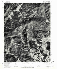
1977 Map of Swift Run Gap
USGS Topo · Published 1982About this map
Blue Ridge terrain dominates this orthophotoquad, where the transition from high ridgelines to narrow valley bottoms defines the historical settlement patterns of the region. The map captures the alignment of Skyline Drive as it winds along the crest through Swift Run Gap, a critical mountain crossing since colonial times. Below the ridges, agricultural clearings and small communities such as Bacon Hollow, Haneytown, and Dyke follow the natural drainage of the Roach River and Lynch River. This 1977 aerial survey provides a clear view of the land-use contrast between protected parklands and the private valley farms. Features like Sandy Bottom and Shady Grove illustrate the enduring local geography of Greene County, showing how historical roads and homesteads were constrained by the steep topography of the Swift Run and Hawksbill Creek watersheds.
Find a feature on this map
12 named features on this map. Tap any name to fly to it.
Don’t see what you’re looking for? This feature index may not catch every label — zoom into the map to look around manually.
Map Details
Editions of this 1977 Swift Run Gap Map
This is the sole edition of this map. No revisions or reprints were ever made.
Other maps of this area

1892 · Gordonsville
USGS Topo · 1:125,000

1892 · Harrisonburg
USGS Topo · 1:125,000

1930 · Madison
USGS Topo · 1:48,000

1931 · University
USGS Topo · 1:62,500

1933 · Madison
USGS Topo · 1:62,500

1935 · Charlottesville
USGS Topo · 1:62,500

1935 · University
USGS Topo · 1:62,500

1937 · Elkton
USGS Topo · 1:62,500

1939 · Charlottesville
USGS Topo · 1:62,500

1949 · Charlottesville
USGS Topo · 1:250,000