2022 Map of Swisher
USGS Topo · Published 2022About this map
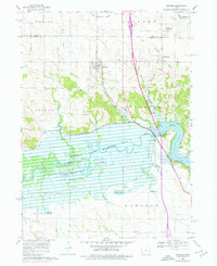
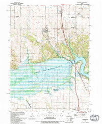
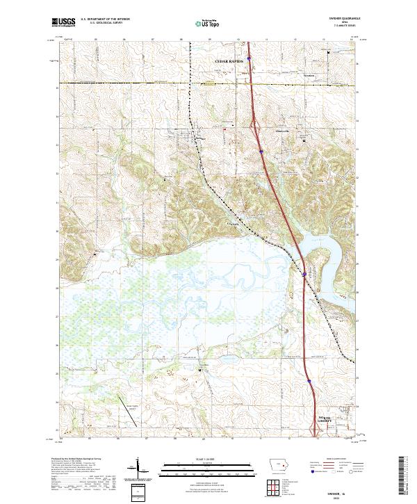
The Iowa River carves a wide path through the center of this Johnson County landscape, creating a series of backwater features like Swan Lake, Twin Lake, and Goose Lake. Small rural communities and historical crossroads define the upland regions, including Shueyville, Swisher, and Cou Falls. For genealogists, the map is particularly useful for locating several family and community burial grounds that dot the prairie and timber edges, such as Greencastle Cem, Blain Cem, and Anderson Cem. The transition from the more developed southern edge near North Liberty to the rural expanses crossing the Linn Co Johnson Co line highlights the regional growth patterns. Aviation history is noted by the presence of the Green Castle Airport, while the hydrology of the area is further defined by tributaries like Swisher Cr and McAllister Cr feeding into the main river valley.
Find a feature on this map
69 named features on this map. Tap any name to fly to it.
Don’t see what you’re looking for? This feature index may not catch every label — zoom into the map to look around manually.
Map Details
Editions of this 2022 Swisher Map
This is the sole edition of this map. No revisions or reprints were ever made.
Historical Maps of Madison Township Through Time
3 maps found