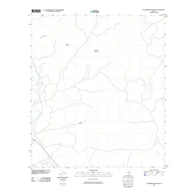
2010 Map of Sycamore Mountain
USGS Topo · Published 2010About this map
Sycamore Mountain dominates this portion of the Texas landscape, rising above a network of drainages that feed into the prominent Nueces River in the southwest corner. The terrain is defined by its deep incisions and prominent heights, most notably the Double Knobs and the expansive Junior Hollow. This 2010 survey illustrates a sparsely populated region where infrastructure is limited to routes like Hwy 334 and Co Rd 408, which follow the natural contours of the land. Water sources are critical landmarks in this environment, with Cave Spring and Sycamore Creek providing vital geographic orientation. The map's detail reflects the complex hydrography of the Edwards Plateau region, tracing the winding paths of Indian Creek and Miller Creek as they carve through the limestone-dominated topography.
Find a feature on this map
11 named features on this map. Tap any name to fly to it.
Don’t see what you’re looking for? This feature index may not catch every label — zoom into the map to look around manually.
Map Details
Editions of this 2010 Sycamore Mountain Map
This is the sole edition of this map. No revisions or reprints were ever made.
Other maps of this area

1893 · Nueces
USGS Topo · 1:125,000

1896 · Nueces
USGS Topo · 1:125,000

1896 · Brackett
USGS Topo · 1:125,000

1897 · Brackett
USGS Topo · 1:125,000

1898 · Uvalde
USGS Topo · 1:125,000

1899 · Uvalde
USGS Topo · 1:125,000

1938 · Turkey Mountain
USGS Topo · 1:48,000

1943 · Turkey Mountain
USGS Topo · 1:62,500

1944 · Barksdale
USGS Topo · 1:62,500

1954 · San Antonio
USGS Topo · 1:250,000