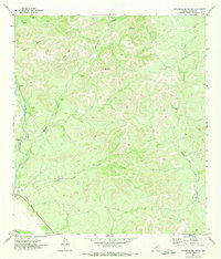
1971 Map of Sycamore Mountain
USGS Topo · Published 1973About this map
The Nueces River carves a deep path through the western edge of this Uvalde County landscape, providing a sharp contrast to the high, broken ground to the east. This 1970s topography highlights the skeletal remains of past infrastructure, most notably the Old Railroad Grade that parallels the river, tracing a legacy of transportation along the water's edge. Inland, the terrain is defined by dramatic limestone features such as Sycamore Mountain and the Double Knobs, while drainage patterns like Long Hollow and Junor Hollow funnel toward the main watercourses.
Find a feature on this map
21 named features on this map. Tap any name to fly to it.
Don’t see what you’re looking for? This feature index may not catch every label — zoom into the map to look around manually.
Map Details
Editions of this 1971 Sycamore Mountain Map
This is the sole edition of this map. No revisions or reprints were ever made.
Other maps of this area

1893 · Nueces
USGS Topo · 1:125,000

1896 · Nueces
USGS Topo · 1:125,000

1896 · Brackett
USGS Topo · 1:125,000

1897 · Brackett
USGS Topo · 1:125,000

1898 · Uvalde
USGS Topo · 1:125,000

1899 · Uvalde
USGS Topo · 1:125,000

1938 · Turkey Mountain
USGS Topo · 1:48,000

1943 · Turkey Mountain
USGS Topo · 1:62,500

1944 · Barksdale
USGS Topo · 1:62,500

1954 · San Antonio
USGS Topo · 1:250,000