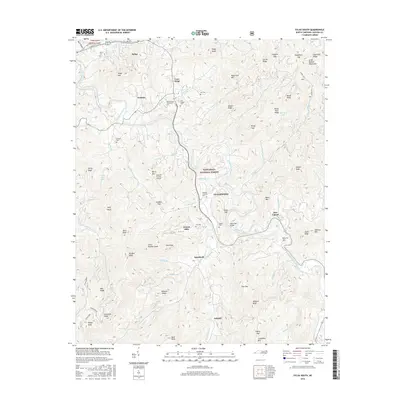
2016 Map of Sylva South
USGS Topo · Published 2016About this map
Cullowhee and the Western Carolina University campus dominate this landscape, which is defined by the winding course of the Tuckasegee River. To the north, the county seat of Sylva and the town of Webster occupy the lower elevations before the terrain rises sharply toward the Great Balsam Mountains. The map documents a dense network of family history markers, including the Parris, Ash, and Wyke cemeteries, which are scattered among the ridges and gaps. Large portions of the territory are protected within the Nantahala National Forest, where the Jackson County Airport sits atop Berry Mountain. The geography is intricately carved by numerous tributaries like Cullowhee Creek and Caney Fork, illustrating how development in this part of Jackson County has historically followed the narrow valley floors between significant peaks like Black Mountain and Kings Mountain.
Find a feature on this map
91 named features on this map. Tap any name to fly to it.
Don’t see what you’re looking for? This feature index may not catch every label — zoom into the map to look around manually.
Map Details
Editions of this 2016 Sylva South Map
This is the sole edition of this map. No revisions or reprints were ever made.
Other maps of this area

1891 · Cowee
USGS Topo · 1:125,000

1897 · Cowee
USGS Topo · 1:125,000

1907 · Cowee
USGS Topo · 1:125,000

1933 · Bryson
USGS Topo · 1:62,500

1935 · Tuckaseigee
USGS Topo · 1:24,000

1935 · Hazelwood
USGS Topo · 1:24,000

1935 · Cullowhee
USGS Topo · 1:24,000

1935 · Addie
USGS Topo · 1:24,000

1935 · Glenville
USGS Topo · 1:24,000

1935 · Corbin Knob
USGS Topo · 1:24,000