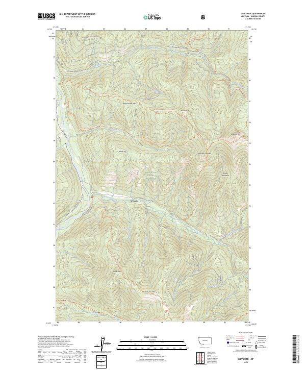
2024 Map of Sylvanite
USGS Topo · Published 2024About this map
Sylvanite sits at the intersection of mountain forest and river valley within the Kootenai National Forest of northwestern Montana. This 2024 map details a landscape defined by the winding course of the Yaak River and the high peaks of the Purcell Mountains. The geography is etched with an extensive network of drainage creeks and historical trails, including the Skyline National Recreation Trl and the Roderick Ridge/Independence Trl, which connect prominent heights like Independence Mtn and Skookum Mtn.
Find a feature on this map
63 named features on this map. Tap any name to fly to it.
Don’t see what you’re looking for? This feature index may not catch every label — zoom into the map to look around manually.
Map Details
Editions of this 2024 Sylvanite Map
This is the sole edition of this map. No revisions or reprints were ever made.
Other maps of this area

1957 · Kalispell
USGS Topo · 1:250,000

1960 · Kalispell
USGS Topo · 1:250,000

1961 · Kalispell
USGS Topo · 1:250,000

1963 · Yaak
USGS Topo · 1:24,000

1963 · Turner Mountain
USGS Topo · 1:24,000

1963 · Sylvanite
USGS Topo · 1:24,000

1963 · Mount Baldy
USGS Topo · 1:24,000

1963 · Pulpit Mountain
USGS Topo · 1:24,000
1963 · Newton Mountain
USGS Topo · 1:24,000

1963 · Clark Mountain
USGS Topo · 1:24,000