
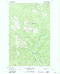
1963 Map of Mount Baldy
USGS Topo · Published 1966About this map
The Kootenai National Forest of the early 1960s is defined by a dense network of watercourses and high peaks, centered on the prominence of Mount Baldy. A Lookout Tower sits atop this peak, overseeing a landscape carved by the Yaak River and its numerous tributaries. The map details the complex drainage systems of Hellroaring Creek, Sunday Creek, and Spread Creek, showing the primitive infrastructure used to navigate this terrain.
Find a feature on this map
29 named features on this map. Tap any name to fly to it.
Don’t see what you’re looking for? This feature index may not catch every label — zoom into the map to look around manually.
Map Details
Editions of this 1963 Mount Baldy Map
2 editions found
Other maps of this area

1911 · Priest Lake
USGS Topo · 1:250,000

1913 · Priest Lake
USGS Topo · 1:250,000

1957 · Kalispell
USGS Topo · 1:250,000

1958 · Sandpoint
USGS Topo · 1:250,000

1960 · Kalispell
USGS Topo · 1:250,000

1961 · Kalispell
USGS Topo · 1:250,000

1963 · Sandpoint
USGS Topo · 1:250,000

1963 · Sylvanite
USGS Topo · 1:24,000

1963 · Northwest Peak
USGS Topo · 1:24,000

1963 · Garver Mountain
USGS Topo · 1:24,000