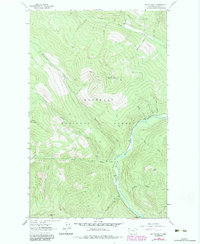
1963 Map of Mount Baldy
USGS Topo · Published 1984About this map
Kootenai National Forest dominates this topographic study of Lincoln County, defined by the sharp elevations of the Purcell Mountains. The landscape is oriented around the Yaak River, which winds through the central valley, fed by numerous tributaries including Hellroaring Creek and Sunday Creek. Human activity is concentrated along the river corridor, evidenced by the Red Top Creek Campground and a Gaging Sta downstream. High-altitude vantage points were critical for forest management during this era, noted by the Lookout Tower atop Mount Baldy. The map documents a primitive transportation network consisting of a Pack Trail that traverses the heights between Thunder Mountain and Red Top Mtn. This 1963 survey, updated with 1982 woodland data, captures the region's character as a managed wilderness where early fire-monitoring infrastructure and remote watercourses define the geography.
Find a feature on this map
24 named features on this map. Tap any name to fly to it.
Don’t see what you’re looking for? This feature index may not catch every label — zoom into the map to look around manually.
Map Details
Editions of this 1963 Mount Baldy Map
2 editions found
Other maps of this area

1911 · Priest Lake
USGS Topo · 1:250,000

1913 · Priest Lake
USGS Topo · 1:250,000

1957 · Kalispell
USGS Topo · 1:250,000

1958 · Sandpoint
USGS Topo · 1:250,000

1960 · Kalispell
USGS Topo · 1:250,000

1961 · Kalispell
USGS Topo · 1:250,000

1963 · Sandpoint
USGS Topo · 1:250,000

1963 · Sylvanite
USGS Topo · 1:24,000

1963 · Mount Baldy
USGS Topo · 1:24,000

1963 · Northwest Peak
USGS Topo · 1:24,000