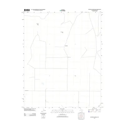
2012 Map of Syndicate Hills
USGS Topo · Published 2012About this map
Syndicate Hills and the Bennett Sand Hills define this high plains landscape in Hartley County during the early 21st century. The terrain is characterized by large ranching tracts and scattered water resources, anchored by the presence of the McCrory Ranch and the landmark Twin Mill. This area of the Texas Panhandle is marked by a sparse but organized road network, including the east-west corridor of Middlewater Rd and north-south connectors like Co Rd 13 and Co Rd 16. The seasonal or intermittent nature of local water sources is represented by Mildred Lake, which provides a vital geographic marker in an otherwise arid expanse. The map illustrates the transition from natural sand hills to managed rangeland, offering a clear view of the ranching infrastructure that sustains the region.
Find a feature on this map
8 named features on this map. Tap any name to fly to it.
Don’t see what you’re looking for? This feature index may not catch every label — zoom into the map to look around manually.
Map Details
Editions of this 2012 Syndicate Hills Map
This is the sole edition of this map. No revisions or reprints were ever made.
Other maps of this area

1954 · Tucumcari
USGS Topo · 1:250,000

1954 · Dalhart
USGS Topo · 1:250,000

1958 · Tucumcari
USGS Topo · 1:250,000

1958 · Dalhart
USGS Topo · 1:250,000

1962 · Dalhart
USGS Topo · 1:250,000

1971 · Middle Water
USGS Topo · 1:24,000

1971 · Syndicate Hills
USGS Topo · 1:24,000

1971 · Beck Ranch
USGS Topo · 1:24,000

1971 · Whiteaker Ranch
USGS Topo · 1:24,000

1973 · King SW
USGS Topo · 1:24,000