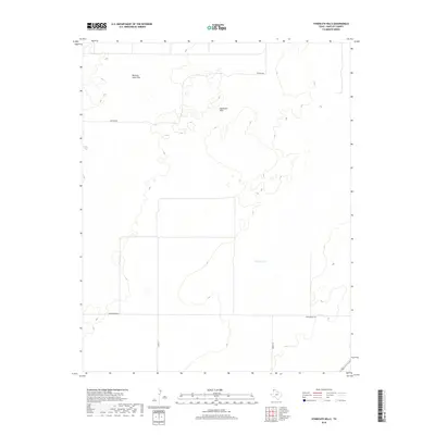
2019 Map of Syndicate Hills
USGS Topo · Published 2019About this map
Syndicate Hills and the Bennett Sand Hills define this corner of the Texas Panhandle, where the topography reveals a subtle but complex landscape of dunes and depressions. The presence of Mildred Lake provides a central hydrologic point in an area otherwise characterized by vast stretches of rangeland. This 2019 survey documents the modern road network essential for navigating Hartley County, including Newson Rd and Middlewater Rd. The sparse distribution of named features indicates a region focused on large-scale land use, with Co Rd 13 and Brown Rd serving as the primary lifelines through the hills. For those studying contemporary land management or the environmental geography of the high plains, this map details the precise relief and drainage patterns that influence this specific section of the Texas landscape.
Find a feature on this map
7 named features on this map. Tap any name to fly to it.
Don’t see what you’re looking for? This feature index may not catch every label — zoom into the map to look around manually.
Map Details
Editions of this 2019 Syndicate Hills Map
This is the sole edition of this map. No revisions or reprints were ever made.
Other maps of this area

1954 · Tucumcari
USGS Topo · 1:250,000

1954 · Dalhart
USGS Topo · 1:250,000

1958 · Tucumcari
USGS Topo · 1:250,000

1958 · Dalhart
USGS Topo · 1:250,000

1962 · Dalhart
USGS Topo · 1:250,000

1971 · Middle Water
USGS Topo · 1:24,000

1971 · Syndicate Hills
USGS Topo · 1:24,000

1971 · Beck Ranch
USGS Topo · 1:24,000

1971 · Whiteaker Ranch
USGS Topo · 1:24,000

1973 · King SW
USGS Topo · 1:24,000