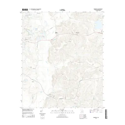
2014 Map of Tabernacle
USGS Topo · Published 2014About this map
Buffalo Cr and its many tributaries, including Panther Run and Wheeler Cr, dominate the drainage of this Washington County landscape. The settlement at Hebron sits in the west, while Brook Springs and Tabernacle are positioned along Ga-24, a central transportation artery. The presence of Kaolin Mines Rd and Kaolin Rd points to the area's industrial heritage in mineral extraction, which has long shaped the local economy. Several family and community burial grounds, such as Ruthford Cem near Sheppards Bridge and the Forbes Cem, are scattered across the terrain, offering significant points of interest for genealogical research. The map also detail various ponds like Cochran Pond and Gorbutt Pond, which punctuate the rural topography alongside numerous winding branches like Dennard Br and Canal Br.
Find a feature on this map
59 named features on this map. Tap any name to fly to it.
Don’t see what you’re looking for? This feature index may not catch every label — zoom into the map to look around manually.
Map Details
Editions of this 2014 Tabernacle Map
This is the sole edition of this map. No revisions or reprints were ever made.
Other maps of this area

1912 · Milledgeville
USGS Topo · 1:62,500

1916 · Irwinton
USGS Topo · 1:62,500

1920 · Irwinton
USGS Topo · 1:62,500

1953 · Athens
USGS Topo · 1:250,000

1957 · Macon
USGS Topo · 1:250,000

1958 · Macon
USGS Topo · 1:250,000

1958 · Athens
USGS Topo · 1:250,000

1959 · Athens
USGS Topo · 1:250,000

1961 · Deepstep
USGS Topo · 1:24,000

1961 · Warthen
USGS Topo · 1:24,000