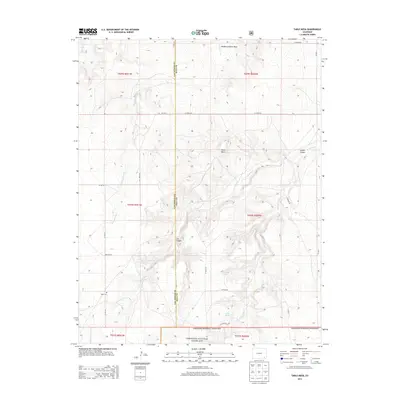
2013 Map of Table Mesa
USGS Topo · Published 2013About this map
The high plains of Las Animas and Baca Counties meet at this remote section of the Comanche National Grassland, where the terrain is defined by deep incisions like Soldier Canyon and Cat Canyon. The landscape is a study in arid-land survival and cattle ranching history, centered around natural water sources such as Watt Spring, O'Hair Spring, and Twin Springs. The northern portion is dominated by the broad plateau of Table Mesa and the expansive McAfee Godwin Vega. Evidence of early 20th-century settlement is found in the southwestern corner, where the Robb School and Robb Cem remain as markers of a once-active rural community. A network of county roads, including Co Road MM and Co Road DD, traces the section lines across this isolated stretch of the Colorado steppe.
Find a feature on this map
33 named features on this map. Tap any name to fly to it.
Don’t see what you’re looking for? This feature index may not catch every label — zoom into the map to look around manually.
Map Details
Editions of this 2013 Table Mesa Map
This is the sole edition of this map. No revisions or reprints were ever made.
Other maps of this area

1891 · Higbee
USGS Topo · 1:125,000

1891 · Springfield
USGS Topo · 1:125,000

1892 · Two Butte
USGS Topo · 1:125,000

1892 · Mt Carrizo
USGS Topo · 1:125,000

1893 · Higbee
USGS Topo · 1:125,000

1893 · Two Butte
USGS Topo · 1:125,000

1893 · Springfield
USGS Topo · 1:125,000

1955 · La Junta
USGS Topo · 1:250,000

1958 · La Junta
USGS Topo · 1:250,000

1968 · La Junta
USGS Topo · 1:250,000